Bluebell Homepage

Interactive Northern Extension Maps


The extension is currently deemed a construction site and access is forbidden unless express permission has been given by either Ron Harwood or Paul Robertson. Please respect this for your own safety! As the next best thing, this map is available to illustrate the progress made thus far.


Map 1: Kingscote to Imberhorne Tip

Click to view pictures Click to view picture Click to view pictures Click to view pictures Click to view pictures Click to view pictures Click to view pictures Click to view pictures Click to view pictures Click to view pictures Click to view pictures Click to view pictures Click to view pictures Click to view pictures Click to view pictures Click to go to the next map

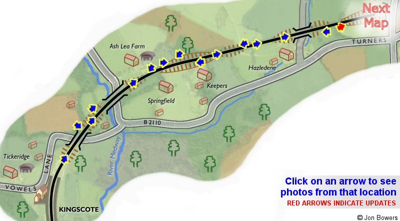
Click on an arrow on the map to view the photos at that location, or click
here to view all the thumbnails on one page.


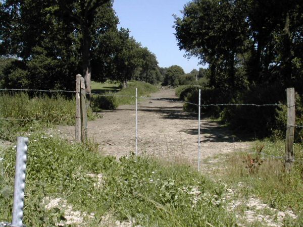
Looking north at the former cattle crossing

Click for larger version

Date: 13th July 2003

In this first view, the formation has been cleared and levelled either side of the Hazleden cattle crossing, which was at this time no longer in use.

Enlargements: Small (75kb) - Large (183kb)

Click for larger version

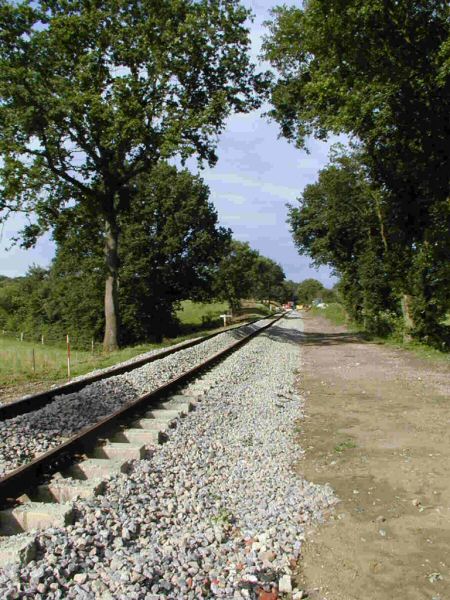
Date: 10th July 2004

A year later, and tracklaying has passed the site of the crossing. There is a large culvert under the line at this point, marked by the line of trees running in from the field on the left.

Enlargements: Small (86kb) - Large (170kb)

Photo: Martin Oakley

Back to Map - Go to Extension Maps Index Page


Please note that although every effort has been made to make these maps as accurate as possible, I can't accept responsibility for any inaccuracies. Comments and suggestions are welcome by email please.

All un-credited photos were taken by Jon Bowers while working with the Sunday P-Way gang, either during authorised visits to the worksite or while delivering materials for the FOK / extension team. Other photos are by Dave Clarke, Martin Oakley and Steve Garratt, to whom many thanks. All photos remain the copyright of the photographer.


splash
Extension Background - Latest Extension News - Land Purchase Fund


Return to Bluebell Home Page, to the Timetable or to Special Events

Visitor Info. - Catering - Contacts - What's New - Extension - Locos - Carriages - Signals - History - Other - Links - Search & Index - FAQ
Why not become a BRPS Member? - Get more involved as a Volunteer

Last updated 29th October 2004 by Jon Bowers.
All photos © Jon Bowers unless otherwise stated.
© Copyright, disclaimer and credits.
Click for larger version

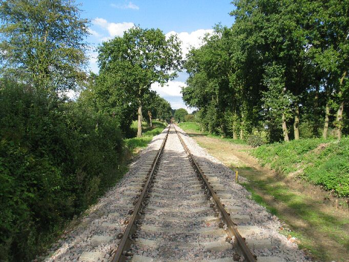
Date: 21st August 2004

The track, which now stretches much further into the distance, was looking much more presentable by the time this photo was taken, having received the attentions of both a ballast regulator and a tamper.

Enlargements: Small (68kb) - Large (194kb)

Photo: Dave Clarke