Map 2: Imberhorne Tip area
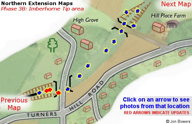
Please note that for clarity, this map is presented at a larger scale than the previous one.
The distance between the two bridges is approximately 600 yards.
<
font size="5">
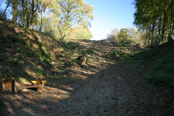
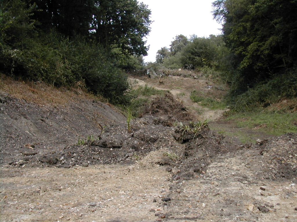
Looking up at the south-western end of the tip
|
Date: 8th August 2004
Looking up at the start of the tip from the end of the long straight up from Ash Lea farm.
Thi
s section of tip (south of Imberhorne Lane bridge) is owned by the Bluebell, and comprises around 18,000 cubic metres of clay and sandstone,
mostly originating from the early 1970s development of Beeching Way in East Grinstead (a bypass on the route of the old railway line to Forest Row).
Enlargements: Small (68kb) - Large (183kb)
|
|
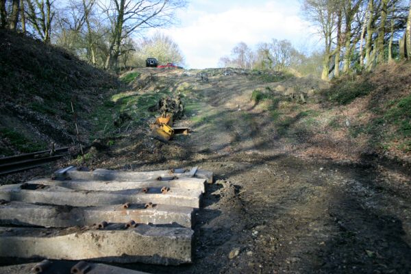
Date: 14th November 2004
The view a few months later is a lot more presentable, with the face of the tip having been subject to further vegetation clearance.
Enlargements: Small (61kb) - Large (175kb)
|
|
Date: 25th March 2005
Over the Easter weekend in March 2005, work started to lay a further five panels of track to extend the line right up to the face of the tip, as part of the
preparations for spoil removal by rail to Horsted Keynes.
Enlargements: Small (65kb) - Large (189kb)
|
|
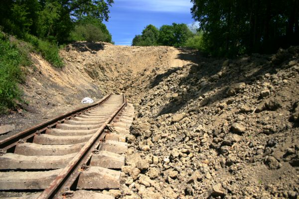
Date: 19
th June 2005
The spoil trains to remove material from the Bluebell owned section of the tip had only been running for 2 weeks when this photo was taken, but had changed the view considerably.
The track has been extended into the excavated section, while material is piled up ready for loading on the right.
Enlargements: Small (78kb) - Large (227kb)
|
Back to M
ap - Go to Extension Maps Index Page
Please note that although every effort has been made to make these maps as accurate as possible, I can't accept responsibility for any inaccuracies.
Comments and suggestions are welcome by email please.
All un-credited photos were taken by Jon Bowers while working with the Sunday
P-Way gang, either during authorised visits to the worksite or while delivering materials for the FOK / extension team.
Other photos are by Dave Clarke, Lewis Norris and Paul Norris, to whom many thanks. All photos remain the copyright of the photographer.

Extension Bac
kground -
Latest Extension News -
Land Purchase Fund
Return to Bluebell Home Page,
to the Timetable
or to Special Events
Visitor Info. -
Catering -
Contacts -
What's New -
Extension -
Locos -
Carriages -
Signals -
History -
Other -
Links -
Search & Index -
FAQ
Why not become a BRPS Member?
 -
Get more involved as a Volunteer
-
Get more involved as a Volunteer
Last updated
2nd July 2005
by Jon Bowers.
All photos © Jon Bowers unless otherwise stated.
© Copyright, disclaimer and credits.��������������������������������������������������������������������������������������������������������������������������������������������������������������������������������
