Map 2: Imberhorne Tip area
Please note that for clarity, this map is presented at a larger scale than the previous one.
The distance between the two bridges is approximately 600 yards.
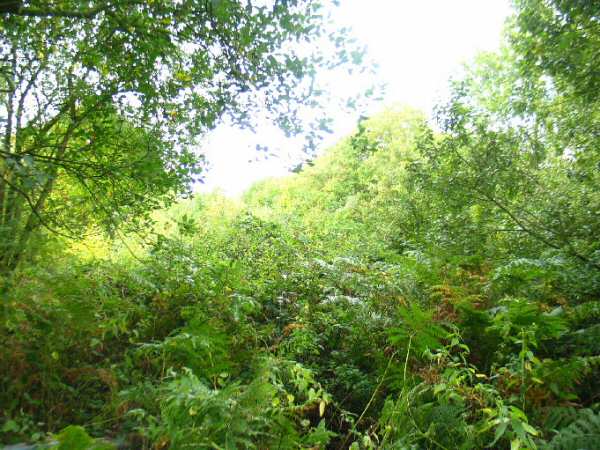
Looking towards Kingscote from Imberhorne Lane bridge
|
Date: 4th October 2003
A picture which illustrates the amount of work that has already been undertaken.
This i
s the view looking over the bridge parapet in Imberhorne Lane, looking back towards Kingscote.
Enlargements: Small (57kb) - Large (187kb)
Photo: Dave Clarke
|
|
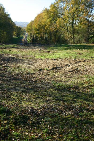
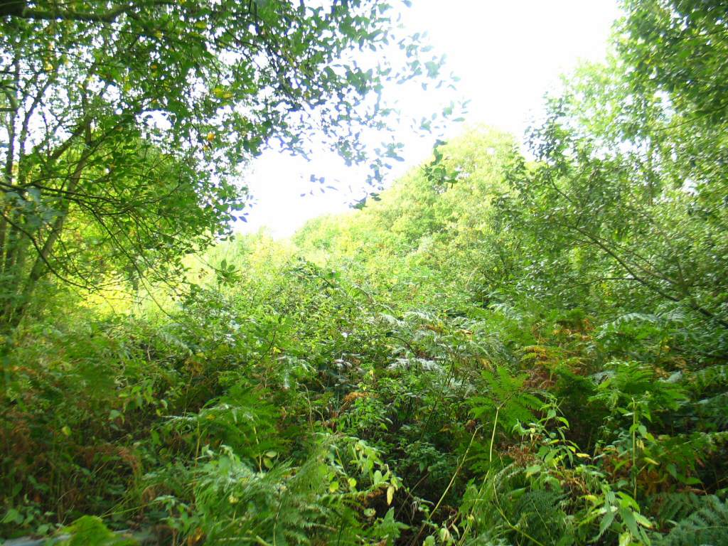
Date: 14th November 2004
The vegetation in the previous picture was cleared in the summer of 2004, which opened up this view back towards Kingscote.
Note that the track is clearly visible from the road, with this view taken from the southern end of the parapet.
Enlargements: Small (68kb) - Large (196kb)
|
|
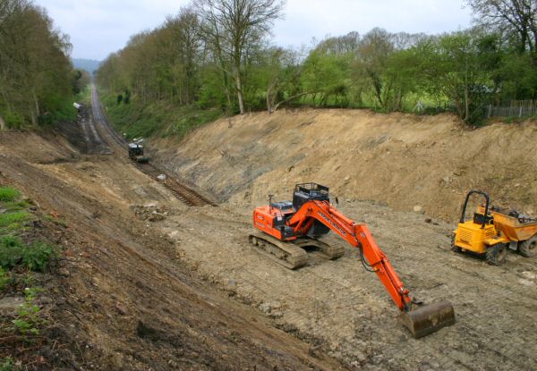
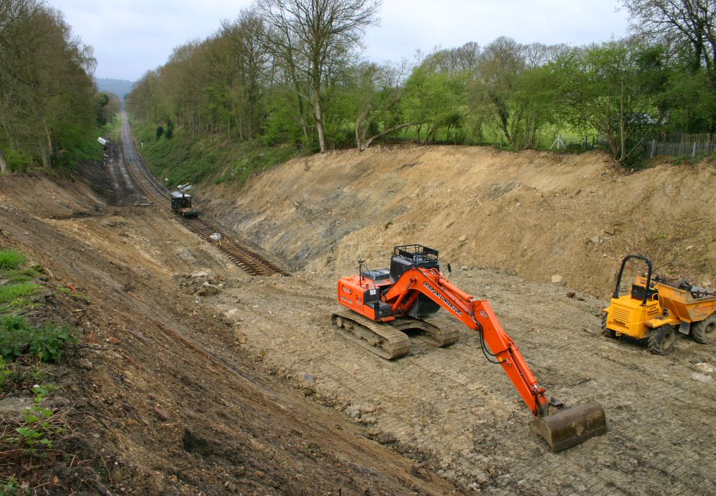
Date: 30th April 2006
A year and a half later, and the removal of spoil has resulted in the major transformation seen here.
The level of the track gives a good indication of the depth of the cutting at this point, while the platform
on which the machines are sitting shows how much spoil is still to be removed.
Enlargements: Small (60kb) - Large (182kb)
|
Back to Map - Go to Extension Maps Index Page
Please note that although every effort has been made to make these maps a
s accurate as possible, I can't accept responsibility for any inaccuracies.
Comments and suggestions are welcome by email please.
All un-credited photos were taken by Jon Bowers while working with the Sunday P-Way gang, either during authorised visits to the worksite or while delivering materials for the FOK / extension team.
Other photos are by Dave Clarke, Lewis Norris and Paul Norris, to whom many thanks. All photos remain the copyright of the pho
tographer.

Extension Background -
Latest Extension News -
Land Purchase Fund
Return to
Bluebell Home Page,
to the Timetable
or to Special Events
Visitor Info. -
Cateri
ng -
Contacts -
What's New -
Extension -
Locos -
Carriages -
Signals -
History -
Other -
Links -
Search & Index -
FAQ
Why not become a BR
PS Member?
 -
Get more involved as a Volunteer
-
Get more involved as a Volunteer
Last updated
1st May 2006
by Jon Bowers, with thanks to Dave Clarke.
All photos © Jon Bowers unless otherwise stated.
© Copyright, disclaimer and credits.�������������������������������������������������������������������������������������������������������������������������������������������������������������������������������������������������������������������������������������������������������������������������������������������������������������������������������������������������������������������������������������������������������������