Bluebell Homepage

Interactive Northern Extension Maps


The extension is currently deemed a construction site and access is forbidden unless express permission has been given. Please respect this for your own safety!

If you would like to help the work progress, why not become an extension volunteer? Email Nigel Longdon for further information (remove .NOSPAM before sending).
As the next best thing, these maps are available to illustrate the progress made thus far.


Map 3: Hill Place Brid ge to East Grinstead

Click to view pictures Click to view pictures Click to view pictures Cli
ck to view pictures Click to view pictures Click to view pictures Click to view pictures Click to view pictures Click to view pictures Click to view pictures Click to view pictures Click to view pictures Click to view pictures Click to view pictures Click to view pictures Click to view pictures Click to go to the previous map

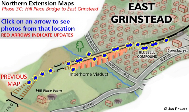
Click on an arrow to display pictures from that location.


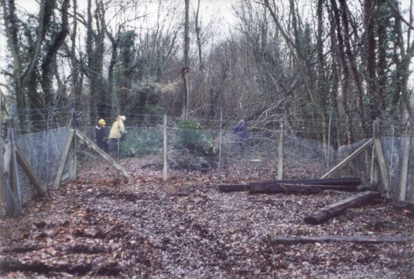
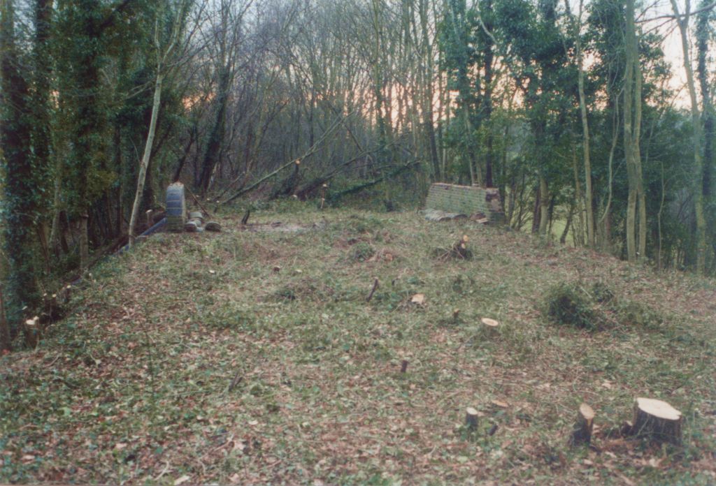
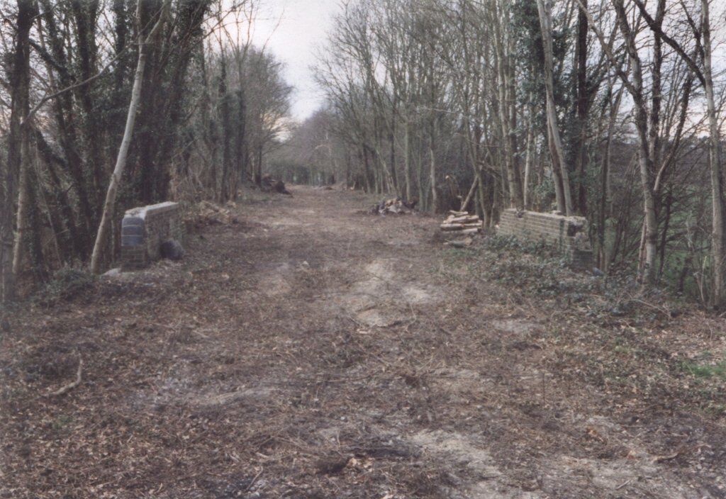
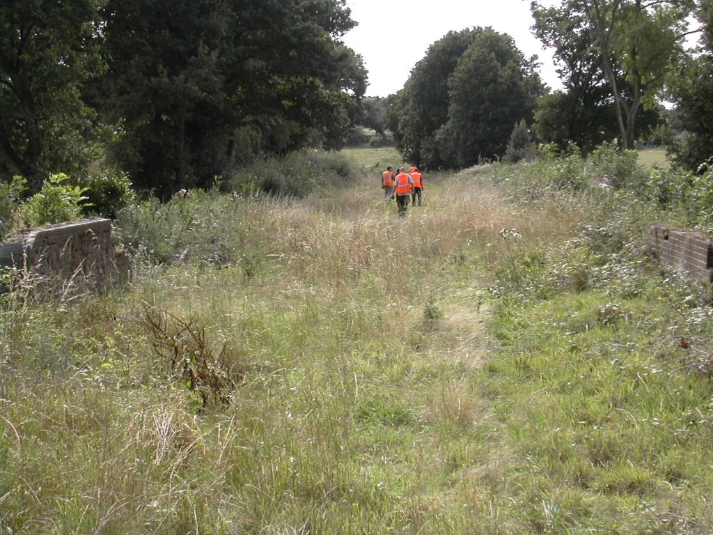
Looking towards Kingscote at Hill Place Cattle Creep

Click for larger version

Date: 7th January 1996

This sequence of photos show just how much work has already taken place to get the trackbed into a suitable condition, before laying track can even be considered!

Enlargements: Small (67 kb) - Large (170 kb)

Photo: Lewis Norris

Click for larger version

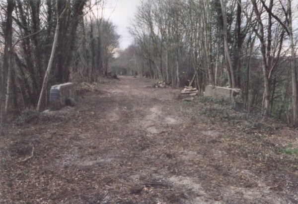
Date: 4th February 1996
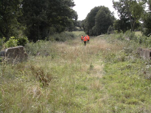
Less than a month after the previous picture was taken, and the fence at the end of Imberhorne viaduct has gone and Hill Place cattle-creep can be seen.

Enlargements: Small (59 kb) - Large (153 kb)

Photo: Lewis Norris

Date: February 1998

In early 1998, the rest of the trackbed from the viaduct to Hill Place bridge was purchased, allowing vegetation clearance to continue towards the tip.

Enlargements: Small (67 kb) - Large (173 kb)

Photo: Paul Norris

Click for larger version

Date: 7th June 1998

A summertime version of the previous picture, with more trees having been removed in the distance and from the embankment sides.

Enlargements: Small (66 kb) - Large (169 kb)

Photo: Lewis Norris

Click for larger version

Date: 22nd August 2004

A more recent view, with only light vegetation present and the trackbed in a much more manageable condition.

Enlargement s: Small (71 kb) - Large (195 kb)

Back to Map - Go to Extension Maps Index Page


Please note that although every effort has been made to make these maps as accurate as possible, I can't accept responsibility for any inaccuracies. Comments and suggest ions are welcome by email please.

All un-credited photos were taken by Jon Bowers while working with the Sunday P-Way gang, either during authorised visits to the worksite or while delivering materials for the FOK / extension team. Other photos are by Dave Clarke, Lewis Norris, Paul Norris and Tony Frost, to whom many thanks. Many thanks are also due to Dave Clarke for his help with the captions. All photos remain the copyright of the photographer.


splash
Extension Background - Latest Extension News - Land Purchase Fund


Return to Bluebell Home Page, to the Timetable or to Special Events

Visitor Info. - Catering - Contacts - What's New - Extension - Locos - Carriages & Wagons - Signals - History - Other - Links - Search the site - FAQ
Why not become a BRPS Me mber? - Get more involved as a Volunteer

Last updated 26th March 2005 by Jon Bowers.
© Copyright, disclai mer and credits.