![]()
Interactive Northern Extension Maps
The extension is currently deemed a construction site and access is forbidden
unless express permission has been given.
Please respect this for your own safety!
If you would like to help the work progress, why not become an extension volunteer?
Email Nigel Longdon for further information (remove .NOSPAM before sending).
As the next best thing, these maps are available to illustrate the progress made thus far.
Map 1: Kingscote to I mberhorne Lane Bridge
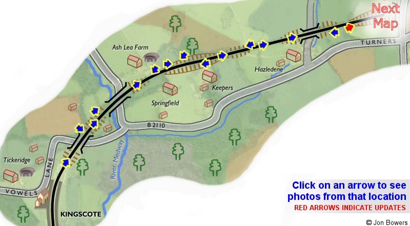
Click on an arrow on the map to view the photos at that location.
The length of track sh
own is approximately 1 mile.
Map 2: Imberhorne Tip area
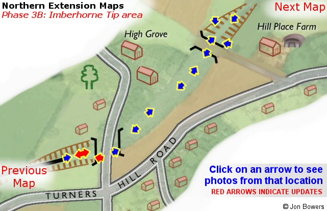
Please note that for clarity, this map is presented at a larger scale than the previous one.
The distance between the two bridges is approximately 600 yards.
Map 3: Hill Place Bridge to East Grinstead
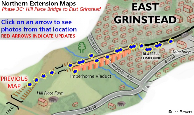
The length of track depicted in this map is approximately 3/4 of a mile.
Please note that although every effort has been made to make these maps as accurate as possible, I can't accept responsibility for any inaccuracies. Comments and suggestions are welcome by email please.
All un-credited photos were taken by Jon Bowers while working with the Sunday P-Way gang, eithe r during authorised visits to the worksite or while delivering materials for the FOK / extension team. Other photos are by Dave Clarke, Martin Oakley, Steve Garratt, Lewis Norris, Paul Norris and Tony Frost, to whom many thanks. All photos remain the copyright of the photographer.
![]()
Extension Background -
Latest Extension News -
Land Purchase Fund