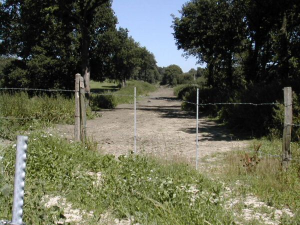
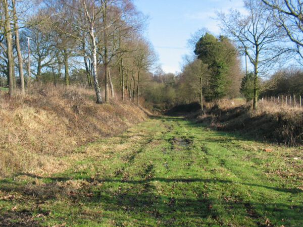
Looking north from Kingscote run-round limit
|
Date: 13th July 2003
This view shows the then northern-most point of the line, used by locos running round their trains at Kingscote.
However, preparation of the trackbed for tracklaying is at an advanced stage, with vegetation cleared, the formation levelled, and markin
g-out pegs (towards the left of the formation) and cabling trenches in evidence.
Enlargements: Small (83kb) - Large (191kb)
|
|
Date: 7th September 2003
This view, taken just a few days after work on the extension commenced, shows the old buffer-stops had been removed, a trap-point installed and 2 panels of bullhead rail laid.
Enlargements: Small (75kb) - Large (188kb)
|
|
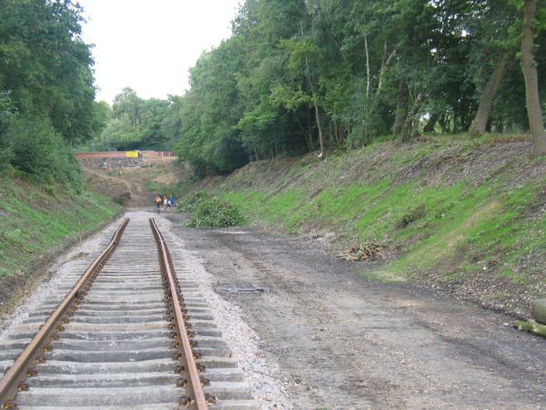
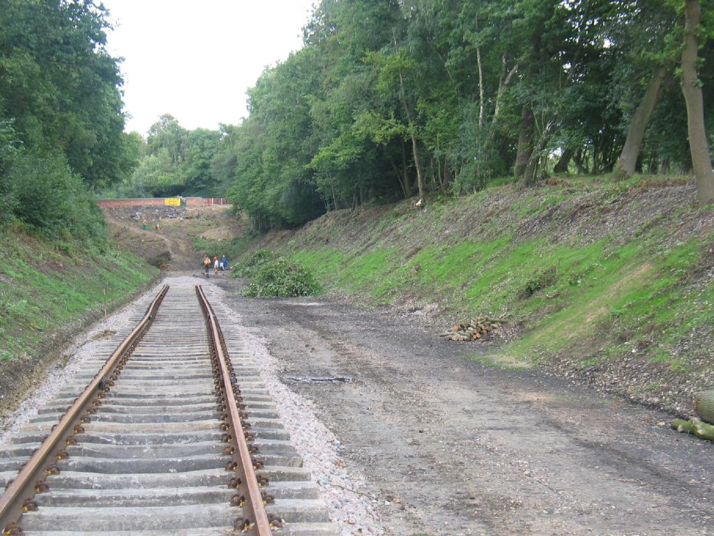
Date: 16th November 2003
The track extends as far as the white signal post in the distance, and had received the attentions of both a Tamper and the Sunday P-way gang.
Enlargements: Small (66kb) - Large (159kb)
|
Back to Map - Go to Extension Maps Index Page
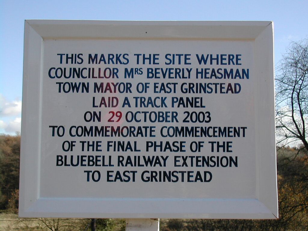
The Commemorative Plaque
|
Date: 16t
h November 2003
A photo that rather speaks for itself! Barry Coward has published this page of photos from the day in question.
Enlargements: Small (50kb) - Large (111kb)
|
Back to Map - Go to Extension Maps Index Page
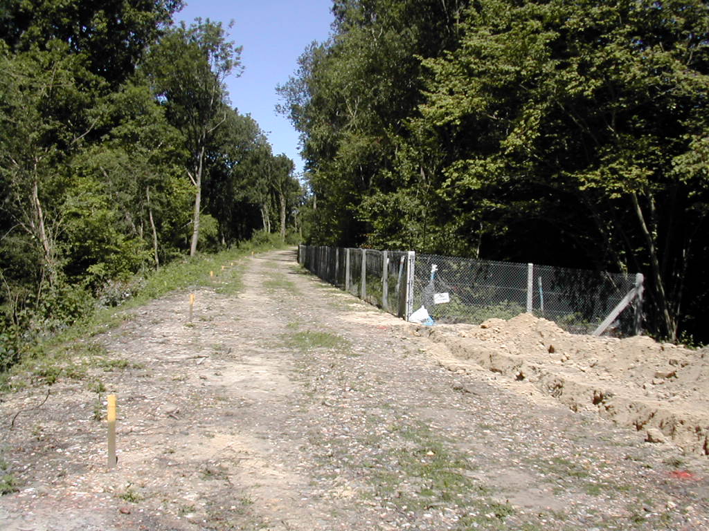
Looking
north at the start of the 'narrow section'
|
Date: 13th July 2003
The view looking around the curve that takes the line over the Turners Hill Road bridge (out of sight in the camera), and w
here for a short distance the Bluebell was only able to purchase half of the original trackbed, hence the rails being laid on the west (up) side of the embankment.
Enlargements: Small (80kb) - Large (185kb)
|
|
Date: 18th April 2004
This picture was taken shortly after this section of track was laid.
The transition from wooden to concrete sleepers is visible just past the signal-post, the latter formerly hosting the Horsted Keynes down inner-home signal, and installed just a short while before the photo was taken.
Enlargements: Small (76kb) - Larg
e (194kb)
|
|
Date: 11th July 2004
With the track having been down for a few months, it's beginning to look like an established railway line, with the weeds to prove i
t!
Enlargements: Small (79kb) - Large (209kb)
|
Back to Map - Go to Extension Maps Index Page
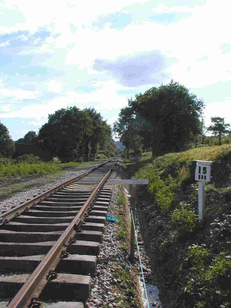
Looking north from the signal post
|
Date: 16th November 2003
The view looking in the East Grinstead direction from the signal post mentioned in the previous caption shows the trackbed cleared ready for ballasting.
Enlargements: Small (69kb) - Large (187kb)
<
/td> |
|
Date: 6th June 2004
This picture clearly shows the point at which the wooden sleepers and bullhead rail gives way to concrete sleepers and flat-bottom rail.
Enlargements: <
a href="04_2m.jpg">Small (85kb) - Large (212kb)
|
Back to Map - Go to Extension Maps Index Page
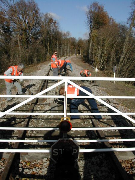
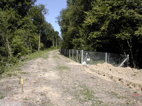
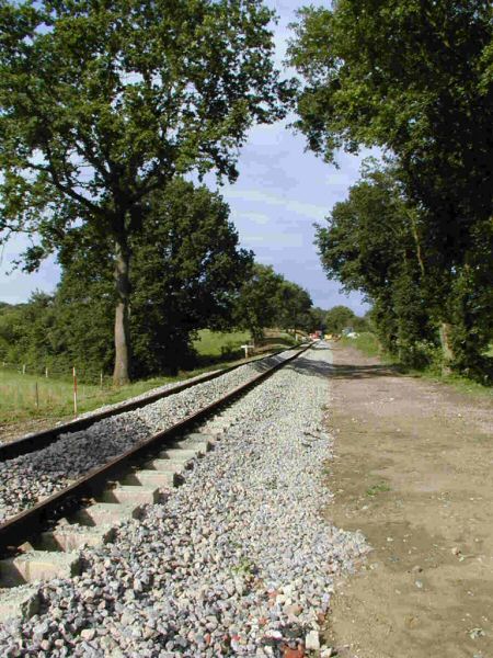
Looking north near Ash Lea Farm
|
Date: 2nd March 2003
The view approaching the end of the embankment alongside Ash Lea farm, looking towards East Grinstead, before the trackbed had been prepared.
Enlargements: Small (90kb)
|
|
Date: 18th April 2004
The ballast has been laid ready to receive the track, which stopped a few panel lengths behind the camera when this photo was taken.
Enlargements: Small (80kb) - Large (185kb)
|
|
Date: 6th June 2004
A similar view a few weeks later, with the track still to be tamped at the time this photo was taken.
Enlargements: Small (76kb) - Large (194kb)
|
Back to Map - Go to Extension Maps Index Page
Looking south from Ash Lea Farm
|
Date:2nd May 2004
By the 2nd May 2004, tracklaying had almost reached the end of the narrow section, and the PW gang were in attendance delivering supplies that had arrived at West Hoathly that morning.
Enlargements: Small (63kb) - Large (170kb)
|
|
Date: 6th June 2004
A similar view just over a month later, with the track down and awaiting tamping. This picture was taken adjacent to the end of the narrow section.
Enlargements: Small (70kb) - Large (183kb)
<
/font>
|
Back to Map - Go to Extension Maps Index Page
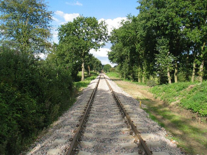
Looking north from the end of the 'narrow section'
|
Date: 13th July 2003
The view looking towards East Grinstead from the end of the curve, shortly after preparatory clearance work and levelling of the formation had been undertaken.
Enlargements: Small (68kb) - Large (182kb)
|
|
Date: 2nd May 2004
A slightly different view at the same location nearly a year later, with the ballasting of this section underway.
Enlargements: Small (51kb) - Large (165kb)
Photo: Steve Garratt
|
|
Date: 6th June 2004
What a difference a month makes! The track is now down, and has begun to stretch away into the distance along the long straight that eventually leads to the Im
berhorne Tip.
Enlargements: Small (55kb) - Large (144kb)
|
Back to Map - Go to Extension Maps Index Page
Looking south from the former Fish Pond
|
Date: 13th July 2003
Looking back towards Kingscote from the site of the former trout farm (marked by the red-brick fill in the bottom of the cutting in the foreground)
Enlargements: Small (80kb) - Large
(185kb)
|
|
Date: 16th June 2004
A fight through the brambles was required to get to the same position nearly a year later!
Enlargements: Small (51kb) - Large (131kb)
|
Back to Map - Go to Extension Maps Index Page
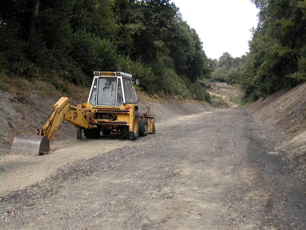
Looking south along Keepers Cutting
|
Date: 6th June 2004
On the 6th June, the rail-head was mid-way along the cutting at the southern end of the straight, with sleepers and ballast in situ ready for laying, although it appears that a delivery of ballast is awaited!
Enlargements: Small (60kb) - Large (147k
b)
|
|
Date: 11th July 2004
There's no shortage of ballast a month later, although at this stage the track was yet to be tamped.
Enlargements: Small (80kb) - Large (195kb)
|
Back to Map - Go to Extension Maps Index Page
Looking north at the former cattle crossing
|
Date: 13th July 2003
In this first view, the formation has been cleared and levelled either side of the Hazleden cattle crossing, which was at this time no longer in use.
Enlargements: Small (75kb) - Large (183kb)
|
|
Date: 10th July 2004
A year later, and tracklaying has passed the site of the crossing.
There is a large culvert under the line at this point, marked by the line of trees running in from the field on the lef
t.
Enlargements: Small (86kb) - Large (170kb)
Photo: Martin Oakley
|
|
Date: 21st August 2004
<
br>
The track, which now stretches much further into the distance, was looking much more presentable by the time this photo was taken, having received the attentions of both a ballast regulator and a tamper.
Enlargements: Small (68kb) - Large (194kb)
Photo: Dave Clarke
|
Back to Map - Go to Extension Maps Index Page
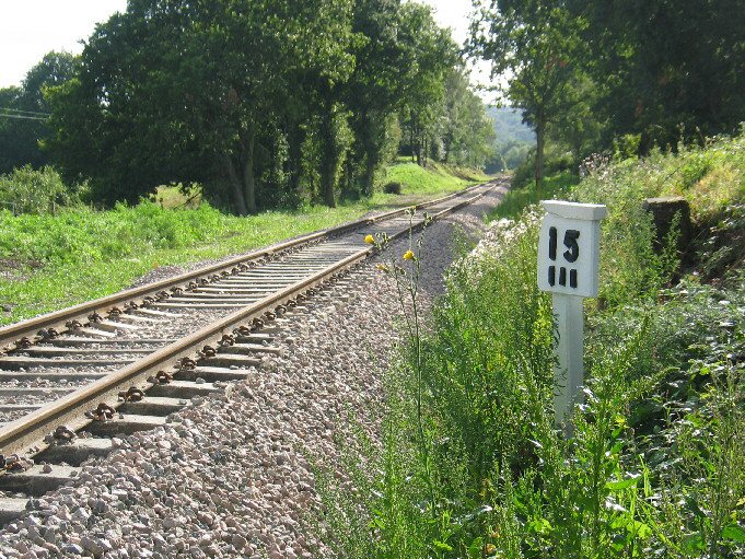
Looking south from the 15 3/4 milepost
|
Date: 6th June 2004
The 15 3/4 mile post
is exactly 3/4 of a mile from the northern ends of the Platforms at Kingscote, and the trackbed had been cleared ready for laying when this photo was taken.
Enlargements: Small (66kb) - Large (167kb)
|
|
Date: 10th July 2004
Just over a month later, the track had passed the milepost, and the new trenches are clearly visible, while the mile post itself had received a lick of paint.
Enlargements: Small (53kb) - Large (130kb)
Photo: Martin Oakley
|
|
Date: 21st August 2004
You could be fooled into thinking the railway had never been away, with the track neatly tamped, the ballast regulated, and nature reclaiming the banks!
Enlargements: Small (70kb) - Large (208kb)
Photo: Dave Clarke
|
Back to Map - Go to Extension Maps Index Page
Looking north towards Hazleden
|
Date: 6th June 2004
The width of the trackbed is apparent in this view, with the former farm buildings visible towards the right of the picture.
Enlargements: Small (65kb) - Large (166kb)
|
|
Date: 11th July 2004
The rail-head had reached this location by the 11th July, with sleepers and rails in-situ ready for further track-laying.
Enlargements: Small (55kb) - Large (136k
b)
|
|
Date: 14th November 2004
The view in mid November, with the track neatly tamped and stretching away towards the tip in the distance.
Enlargements:
Small (68kb) - Large (188kb)
|
Back to Map - Go to Extension Maps Index Page
Looking north over Hazleden Farm Bridge
|
Date: 6th June 2004
This view towards East Grinstead clearly shows the tip looming up in the distance at the end of the straight.
Enlargements: Small (72kb) - Large (194kb)
|
|
Date: 19th July 2004
Work in progress, with the next rail to be used having its end tided up, while one of the installed rails has its fishplate bolt holes bored.
Enlargements: Small (69kb) - Large (175kb)
|
|
Date: 8th August 2004
The view in August with the track laid into the distance and rails stored ready for use just past the bridge on the
right.
For an excellent 'past and present' view at this location, see the back cover of the Autumn 2004 Bluebell News.
Enlargements: Small (62kb) - Large (147kb)
|
Back to Map - Go to Extension Maps Index Page
Looking so
uth over Hazleden Farm bridge
|
Date: 6th June 2004
Looking back towards Kingscote sees signs of activity in the distance as the track approaches in early June.
Enlargements:<
/b> Small (63kb) - Large (146kb)
|
|
Date: 11th July 2004
By the 11th of July, the new line still hadn't reached the bridge
, but the trackbed had been prepared in readiness for track-laying.
Enlargements: Small (75kb) - Large (182kb)
|
|
Dat
e: 8th August 2004
The same view with the track down. No.75027 and a 6 coach test train had been run to just south of this point 5 days before this photo was taken.
Enlargements: Small (81kb) - Large (194kb)
|
Back to Map - Go to Extension Maps Index Page
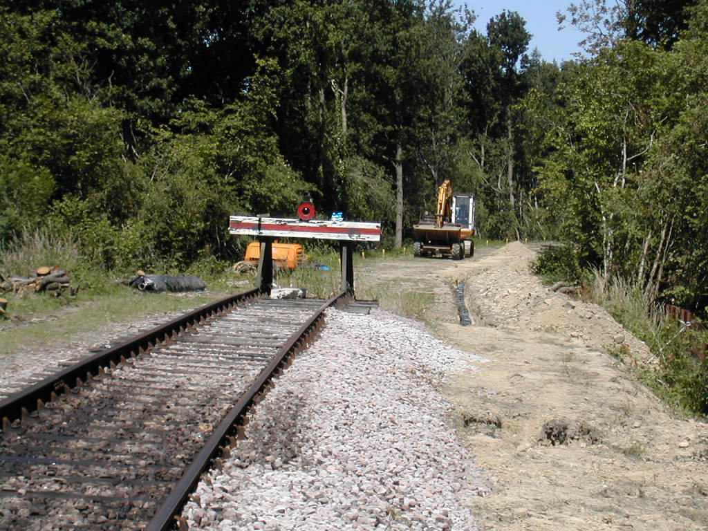
Looking north towards Imberhorne Lane
|
Date: 17th January 2004
Looking towards East Grinstead from Hazleden Farm. The tip starts at the end of th
e straight, and at this point was still covered with vegetation.
Enlargements: Small (81kb) - Large (189kb)
Photo: Dave Clarke
|
|
Date: 8th August 2004
In this August view, taken a few yards nearer to East Grinstead, and from a slightly different viewpoint, the trackbed is being prepared to receive the track.
Note also the vegetation clearance along the cutting sides and onto the tip itself, where Imberhorne Lane bridge can be made out in the distance.
Enlargements: Small (64kb) - Large (162kb)
|
|
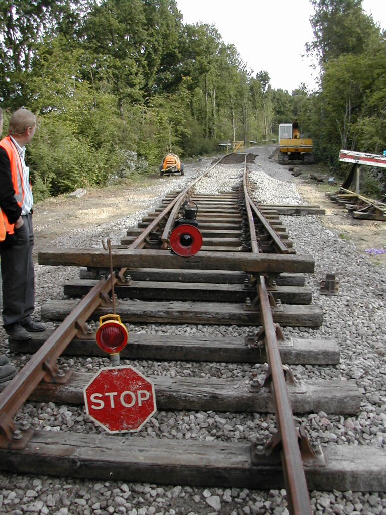
Date: 24th August 2004
Just a few weeks later, and the track has been laid almost up to the southern face of the tip, and there is evidence of more vegetation clearance.
Enlargements:<
/b> Small (65kb) - Large (186kb)
Photo: Dave Clarke
|
Back to Map - Go to Extension Maps Index Page
Please note that although every effort has been made to make these maps as accurate as possible, I can't accept responsibility for any inaccura
cies.
Comments and suggestions are welcome by email please.
All un-credited photos were taken by Jon Bowers while working with the Sunday P-Way gang, either during authorised visits to the worksite or while delivering materials for the FOK / extension team.
Other photos are by Dave Clarke, Martin Oakley and Steve Garratt, to whom many thanks. All photos remain the copyright of the photographer.


